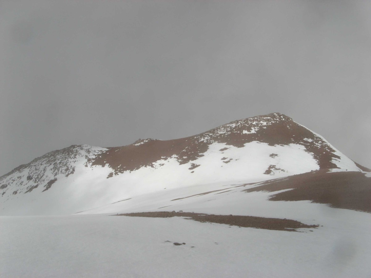
Mountain Belgrano 6100m
The Sierra de Famatina is a separately standing non-volcanic mountain ridge of the Andes located in the province La Rioja (Argentina). Belgrano mountain (also called Nevado de Famatina) is the highest point on the Sierra de Famatina ridge.
The most popular route to climb Belgrano is from the northeastern side. The trail starts from the last abandoned cable station at 4500 m (Estación IX "Upulungos" Cablecarril Mina La Mejicana) and leads to an advanced camp beside a lake at 5800m.
But in this article I want to talk about the less frequented traverse of Belgrano from the south to north-east.
This route has no extra climbing difficulties, so no special equipment is required. But the Andes are rife with nature and climate hardships.We had 9-days of food and gas supply and a very simple set of climbing equipment ( trekking poles, crampons, one rope and 2 ice axes for the group). The backpacks were not heavy and nothing complicated was expected.
 |
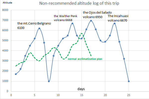 |
| General trip map | altitude log |
Day 1. Our trip started from the “40NM” road at the Miranda river meeting point, where we arrived by car at 1pm. This place is marked “Sisillano” on an old map. The half day plan was to walk about 10 km up to the end of a local abandoned road, climbing from 1800 m to 2200 m altitude.
 |
 |
| Sisillano point | this guy was not friendly |
 |
 |
| a cereus | the road to “primera agua” |
We were too self-confident to think that moving at +50C would be hard, but not dangerous. A combination of medium altitude ~2000m and extreme air temperature led us to heat stroke. After 2 hours of going up, we suddenly got symptoms of nausea and dizziness and we couldn't go on.
Fortunately there was a tree with an abandoned gaucho hut nearby. We went to this place and waited until the sun went down behind the mountains.
At 6 p.m. we started again. Another problem of the area along the road is a shortage of water. At first we predicted finding water at the place named “Primera Agua ” (“first water”). After 2 hours we reached this point, but it looked dry.
I walked 300m up the dry side creek to somegreen bushes. There was a small green oasis with a hidden water stream. There were mosquitoes and I saw a few glossy small fishes in the stream in the headlamp light. We camped in that comfortable place.
In conclusion one can say it is too hard to walk from 11 am to 5 pm due to the extreme heat at altitudes between 1500 and 3000 m. Also, the road to “Primera Agua” is not so bad and this place is achievable by 4WD car and it’s not necessary to go by foot.
Day 2. In the morning we awoke to cloudy skies and went along the Miranda river. The scenery was nice, with red rocks and green slopes. It was another hot day and we reached over 3000m and camped in a wide place called “Puerto viejo”. If we were doing the normal route it would have been good to stay 1-2 days and walk around in this place to improve acclimatization. But we had no time.
 |
 |
| red & green | the miranda river |
Day 3. We started up along the upper part of Miranda river. Above 3000m altitude there was no midday heat. We met a dozen cows and donkeys and a few wild guanakos. We reached altitude 3600m in the early evening and camped.
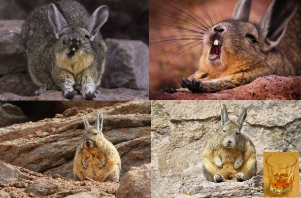
I went for a walk around and had some interesting hypoxic hallucinations. The hallucination looked like a poorly sewn plush brown toy. The plush toy was as drunk as you can imagine. The thing sat among the stones grimaced and showed me its tongue. I closed my eyes and shook my head. This action helped me and the drunken plush brown toy disappeared. While I was walking, I saw the same plush hallucinations several more times. This looked strange, but because we had broken all acclimatization rules I considered that it was normal. Only later, when the trip was over, I found out what Viscachas was.
 |
 |
| Viscachas or Wiskachas? | chamomile flowers |
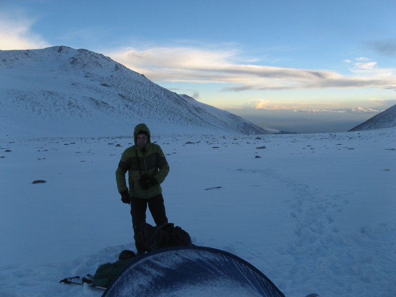
Day 4. We started up along the upper part of Miranda river and reached the 4400m altitude in the early evening at which time we got a 30 minute snow storm. We camped at this place with apprehension that there was no water at the higher place.Cooking with melting snow takes twice as long. We stored water for morning breakfast in bottles inside the tent because the weak water flow in the stream could be frozen at night.
 |
 |
| before the snowstorm | after the snowstorm |
Day 5. Night temperature was about -5C and the snow did not melt. We moved along the upper part of the Miranda river valley. At this altitude, the river Miranda became a small frozen stream.
 |
 |
| The Miranda river at 5000m | The camp at the wide place |
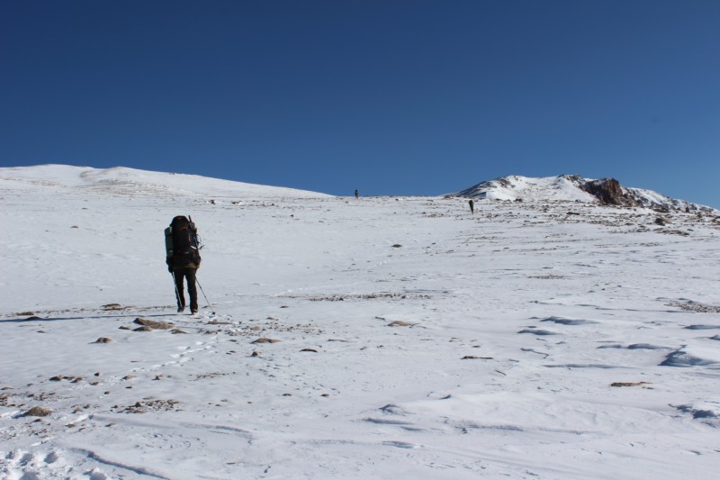
We reached a wide place above 5500m altitude. The day was cloudy and around 4 pm snowfall started, so we camped.
Everyone felt unwell because of the quick ascent. The lack of acclimatization makes you feel like you are not sleeping all night. But you are actually sleeping. This is the usual night effect of the first few days in the mountains.
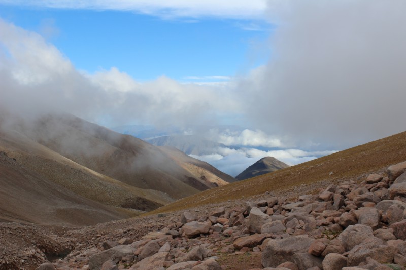
Day 6. Next morning we started towards the hidden lake at 5800m near the summit of the mt.Belgrano. There was a plateau to the south of the summit. The Chilesito town was clearly visible from this point. I turned on my mobile phone but there was no connection. Standard GSM is limited to <35 km.
 |
 |
| The upper plateau | View from the plateau to the Chilecito |
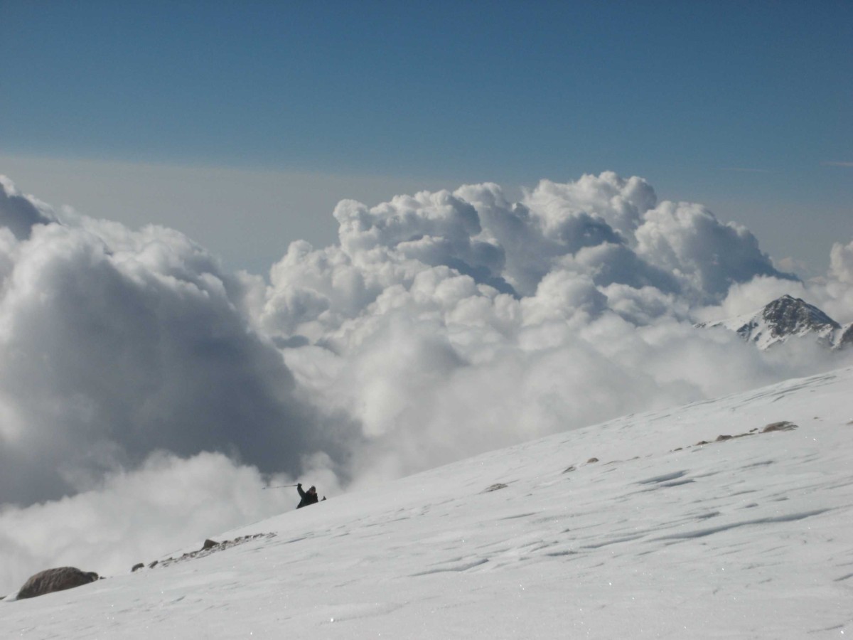
We crossed the lower part of a small south glacier. The area of the south glacier of Belgrano mountain is around 1.5 x 0.2 km. The slope of the glacier was not steep and crampons were optional. Next we got to the lake.
The lake size is about 300х100m. It is mineralized and it has flora and fauna despite an extreme altitude of 5800m. The flora and fauna were like unicellular algae and perhaps micro crustaceans. The water was acceptable to prepare tea and food.
 |
 |
| The high camp at the lake | View to the camp from the top |
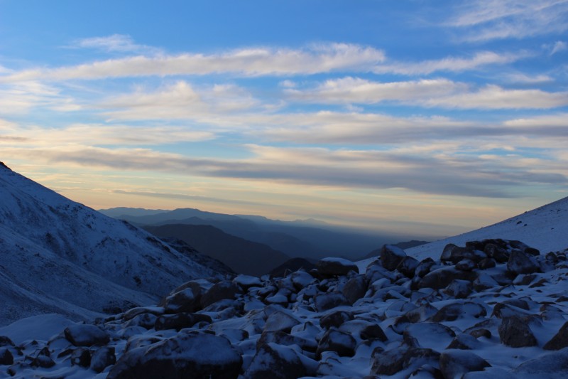
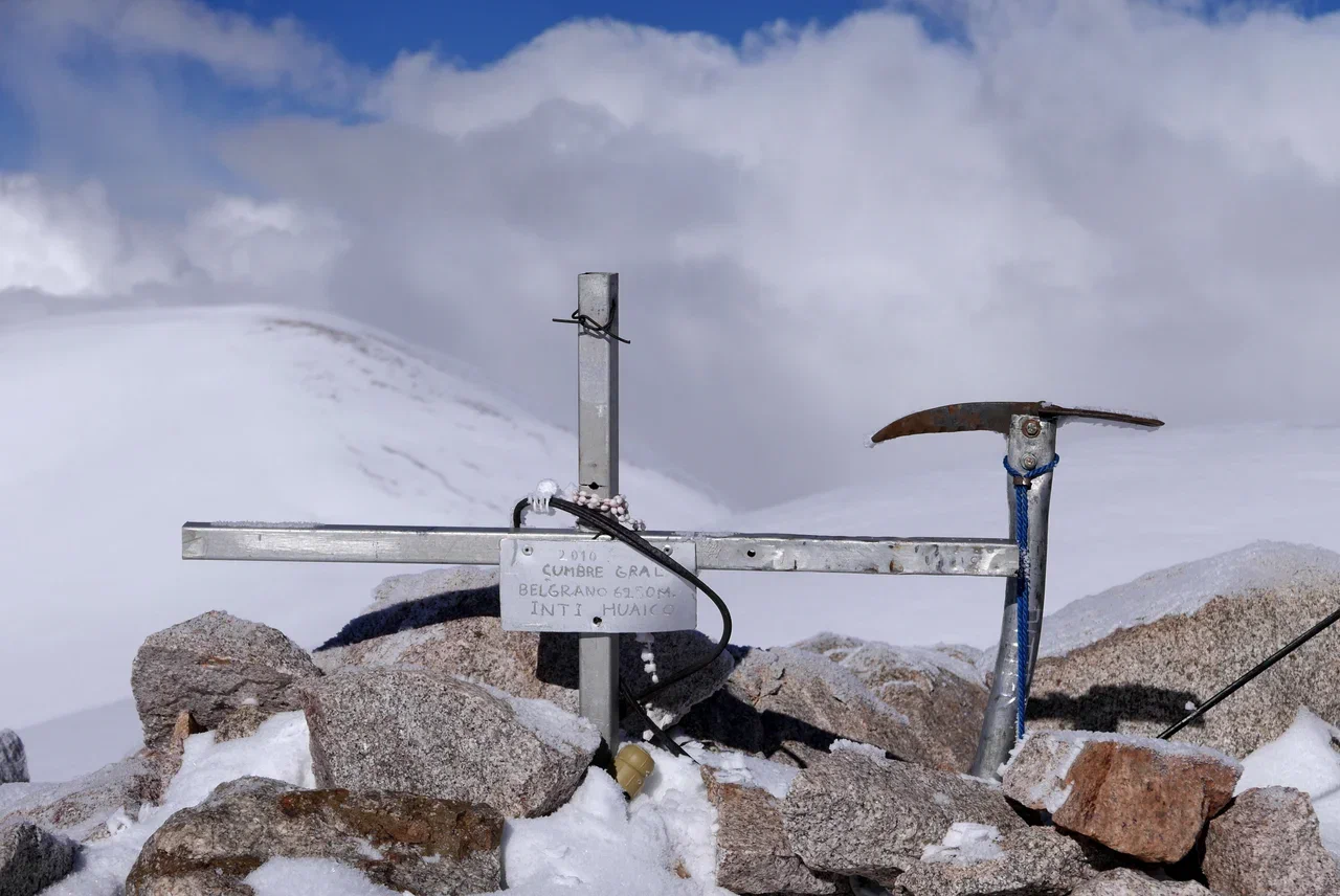
Day 7. The night temperature was around -15 and the lake became partly covered with ice. Night sleep was hard with hypoxic headaches. Someone used paracetamol, aspirin and caffeine mixed into the tablets. But in the morning we left our base camp and went to the top of Belgrano 6100m.
 |
 |
| the final ascending part | near the summit |
The climbing was easy and it took around 2 hours up and 1 hour down from the lake camp. We chose to keep to the glacier, so we used crampons. It’s possible to walk a straight path without ice by the snow covered talus, so if you have experience, you can neglect crampons on the route.
 |
 |
| The summit point ~6100m | frosty crystals |
 |
 |
| south view | east view |
So in the middle of the day we returned to the camp, took a little rest and went down to the upper cable station of the Mine La Mexicana on the same day.
It was a problem finding this trail due to thick fog. But I had the track in the android smartphone, which I usually use as a navigator with offline preloaded satellite images, maps, elevation grid and my own marks. So we found the trail without visibility. The route trail was previously identified from a satellite image and could be plotted manually as a gps-track in the online service.
The descent trail goes on a very loose scree. It was very comfortable to run down.
 |
 |
| The upper part of the trail was under the snow | Trail goes along the local ridge |
Towards dark we reached the upper cable station of the impressive mining industry masterpiece from the early 19th century, the Mine La Mexicana. It was cold rain and we camped inside the abandoned cable car building.
 |
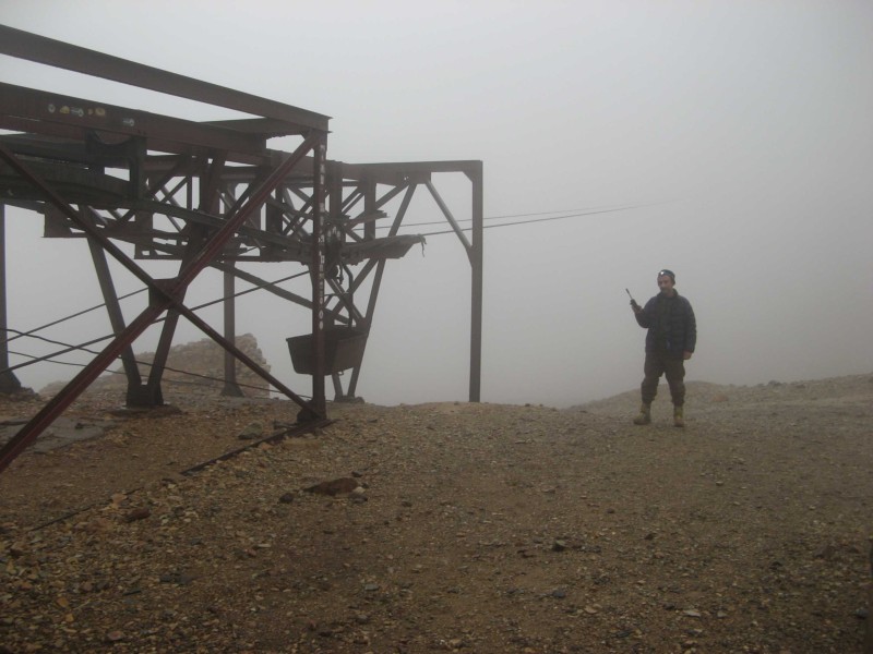 |
| Station 9 "Upulungos" | Nightcall |
Abandoned today, Mine La Mexicana was built in 1905-1908. The "Cablecarril" was used for transporting ore further than 35 kilometers, which is probably a record for a cable car even nowadays. The cable ropeway crosses several mountain ridges, has about 300 supports, and 9 electric power-driven motor stations. All of them are non-working, but still exist. Total elevation difference is from 5000m-1200m. The ore-car traveled to the terminal station in the town of Chilecito (province of La Rioja) for about 6 hours and was reloaded there in the mainline railway cars and next went to Europe by ships.This mine supplied factories with copper ore during the WWI.
Some antique railway equipment of the Orenstein & Koppel company still exists in the vicinity of the mine and has a value for the history of engineering.
 |
 |
| This O&K railway part number is still in stock of Deutsche Bahn ;-) | а railroad switch |
 |
 |
| Mountain mine railway | Antique diesels |
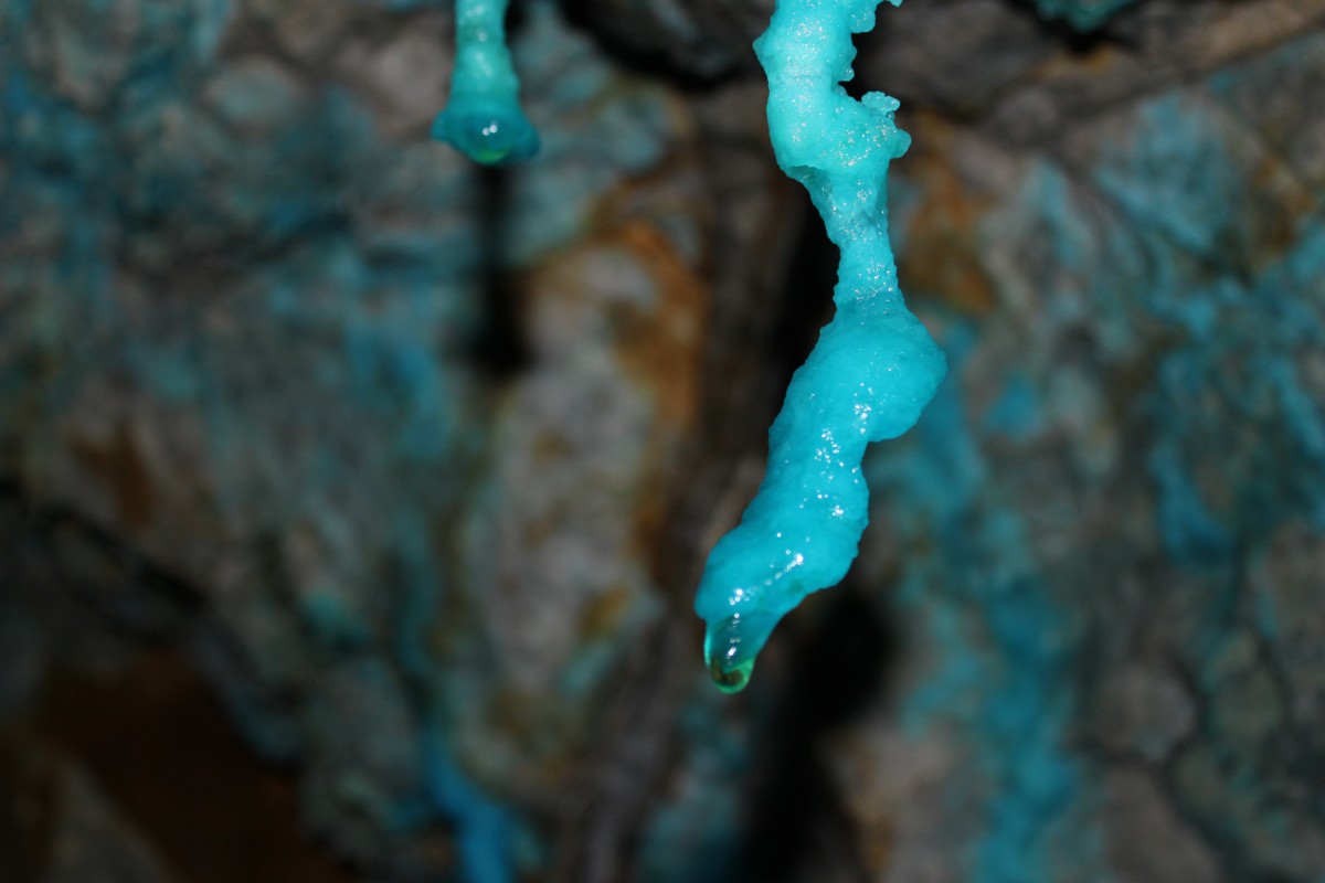
Day 8. In the morning we explored the drifts and galleries of the Mine La Mexicana inside and outside
 |
 |
 |
 |
| Fifty Shades of Blue vitriol |
After inspection of the mine we started going down along the Yellow river. (“Rio Arroyo”) . The coming 25 km looked hard. I had some ideas:
 |
 |
| didn't it go | my ideas didn't work |
Then we quickly went down the road to the canyon "Mina del Ocre"
The Rio Arroyo is polluted with copper, mercury and some other toxic metals. Do not use water from it for food. Use the side springs water.
 |
 |
 |
 |
In the afternoon we met our car which drove us to the next region, where we climbed to Cazadero(Walther Penk), Ojos del Salado and Inca Huasi.
Is the Belgrano peak the highest mountain in South America?
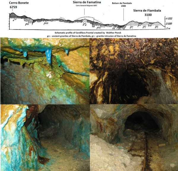
Some sources (Pohl, 2002) suggest that the Argentinian Famatina mountain range is a part of the paleozoic mountain system. Deposits of copper, gold and silver are abundant in the Famatina Range.
The geographic and linguistic idea is that if we exclude volcanoes, mountain Belgrano is the highest non-volcanic mountain in South America!
Some mineral examples in the galleries look like abundant Cu sulfides in the gallery walls. What are the blue crystals and stalactites ? Is it the result of a complex chemical process of oxidation and hydrolysis with infiltrated alkali water that transforms Cu2S to CuSO4 ?
The high-sulphidation epithermal veins is: 1.1% Cu, Ag - 64 ppm , Au - 6 ppm https://portergeo.com.au/database/mineinfo-mb.asp?mineid=mn1338
But in reality copper concentration looked much higher! Also Famatina ridge is famous for the rare mineral Famatinite.
 |
- All data is in the metric system. All left and right directions and sides are specified by the orographic rule
- A link to the the map
- Download gpx file (mountain belgrano route)
- Please don't hesitate to contact me if you have any questions
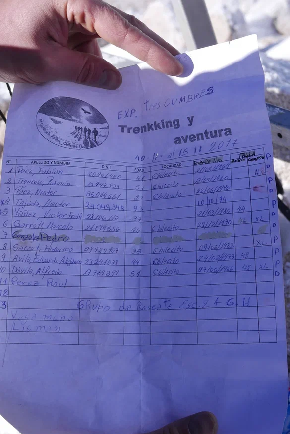
- Summit paper from Trekking y Aventura La Rioja 15/11/2017